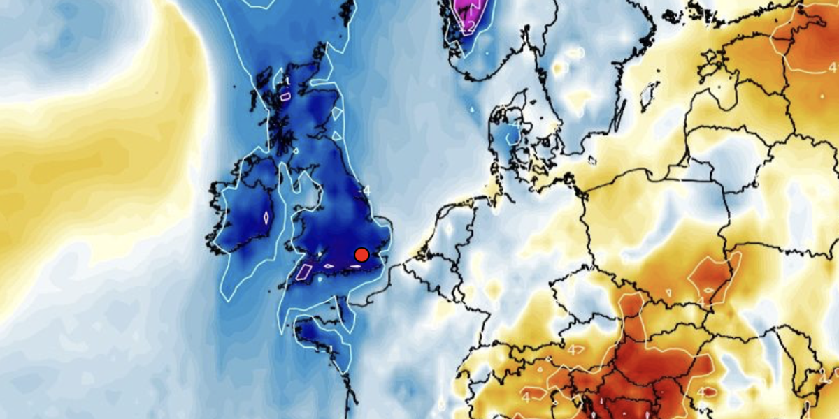
A lid of gloom smothering Britain with cloud is about to shift opening the gates to a bitter Polar blast.
The sun will finally make a brief appearance this week, but temperatures are about to plunge, experts warn.
The stubborn ‘anticyclonic gloom’ which has shrouded the UK in grey will lift as high pressure shifts to the west of the country.
However, it will drive a change in wind direction pulling chilly gusts in from the Arctic Circle.
Britons will notice the first chill later this week before the second half of the month brings a proper taste of winter.
Jim Dale, meteorologist for British Weather Services and social commentator, said: “We are looking at around next weekend when there are signals for a significant drop in temperatures.
“There will be two spells of cold weather, with the first being this week and another through the second half of the month, and the second carries a bit more venom.
“There will also be some fairly strong winds, especially for the east of the country, and these will come down from the Arctic.”
LATEST DEVELOPMENTS:
WX Charts shows 500hPa Geopotential Height and anomaly
WX Charts
Sun-starved Britons will finally see some rays this week as a dome of high pressure smothering the country shifts.
The ‘anticyclonic gloom’ which has delivered parts of the country little more than an hour of sun all month will give way to clearer skies.
However, temperatures will dip through the coming days with the risk of overnight frosts in parts.
Met Office meteorologist Alex Deakin said: “The nights will be quite a lot colder with that cleaner high with a greater chance of some night frosts and some fog patches.
“It’s not especially cold air, but it is cooler and fresher air, and at this time of year, it will feel chilly with the winds coming in from the north sea.
“So, there are strong signals that it will turn a little cooler as we go through the week.”
A cold front crossing the UK will bring more unsettled weather and perhaps a dusting of snow
WX Charts
Met Office meteorologist Aidan McGivern added: “By the time we get to Friday, the most likely situation is that low pressure will start to bring unsettled weather into the north.
“If the jet stream is very elongated, which is suggested by one of the recent model runs, then high build to the west and low pressure will bring colder northerly winds to the UK.
“But this is just one scenario and there are other scenarios in the mix, and it starts to become very uncertain.”
For much of the week, high pressure will be the dominant force meaning clearer skies and little rain.
However, a cold front crossing the UK will bring more unsettled weather and perhaps a dusting of snow.
Dale said: “The sunshine will come back at the start of the week, but there will be some cold around as a front comes through, and this will bring the risk of frosts.
“The rainfall will start to pick up in parts of the country, and with this, there will be a risk of snow as the weather starts to turn colder.”

